East Gippsland Regional Map
One great thing about Australia is that even if you live in the big city outdoor adventures are never far away. You might have to work in Sydney or Melbourne, but once you get behind the wheel of your truck a relaxed day's drive will bring you to East Gippsland. That's good news for pretty much anyone, but it's even better if you're a 4x4 enthusiast. And let's face it, that's probably why you're on this site.
East Gippsland and the Sapphire Coast have some of the best bush walking in the country, and they're also brilliant if you fancy some off-road driving and relaxed camping. A mild climate makes it a good destination year round, although if you go near the mountains in winter bring a snow shovel just in case. The terrain is rugged but not outrageous, so it's ideal for a pleasant break. Make it even better with this Hema map. Taking in two national parks and some awesome beaches, the map covers the Gippsland coast from the Bega River in the north to Lakes Entrance in the south west. Inland it takes you nearly to Mount Beauty. As well as the main road map - beautifully printed and easy to read in 1:300,000 scale - it gives you national park information, distance planning grids, plenty of GPS coordinates and information about the best places to go. These Hema maps almost count as a guidebook too, there's so much on them.
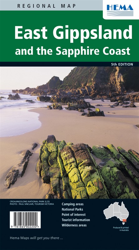
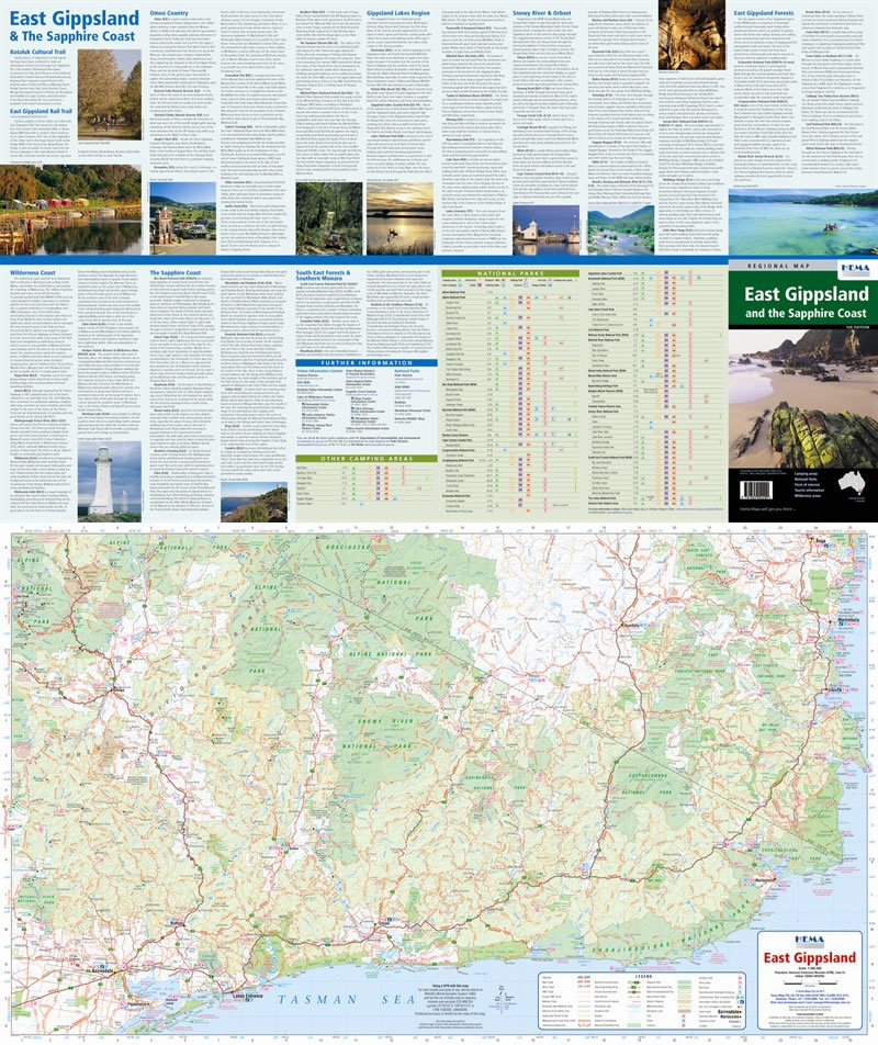
Size: 833x500mm
Edition: 5th
Published: 2009
ISBN: 9781865002200
 Hema Regional Maps
The popular range of regional maps range from touring maps of coastal locations and popular national parks, to the more hardcore 4WD destinations and outback locations. Each product contains information on what there is to do and see in the region too, making them perfect planning tools.
Click here to buy a Hema Regional Map.
Get In Touch
Please use the form below to contact Tough Toys via email.